- Home
- All News Overview
- Pollen-Based Maps of Past Regional Vegetation Cover In Europe Over 12 Millennia—Evaluation and Potential

Thursday, 10 March, 2022
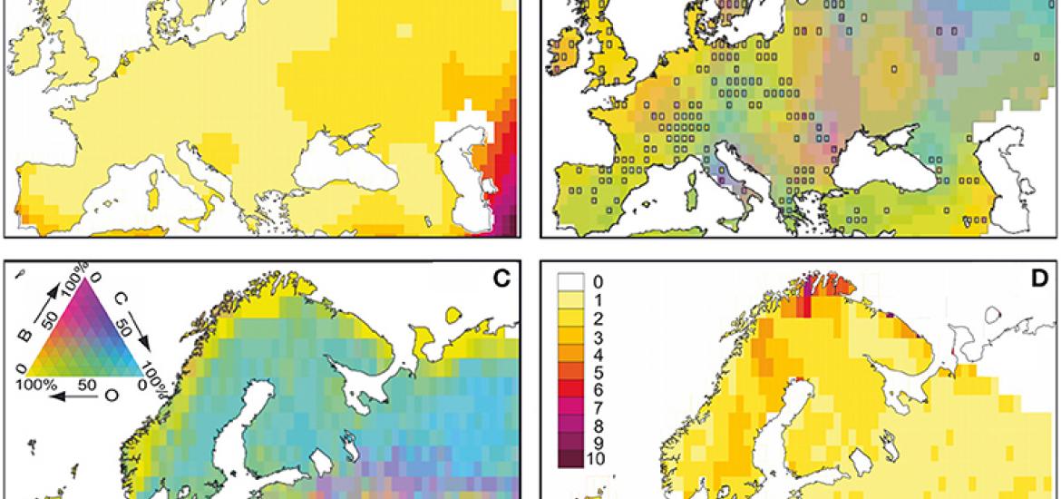
Pollen represents one of the few proxies that can provide spatially-resolved information about past land cover change throughout the Holocene at continental scales, but pollen also provides two major challenges. The first is that pollen data is not an exact mirror of the vegetation in the landscape, for instance, because different plants can produce different quantities of pollen. The second is that pollen data comes from lakes and bogs that do not occur everywhere, and therefore we have difficulty understanding what was happening at locations far away from pollen sites.
Githumbi et al. tackle these problems by combining a number of different types of modelling approaches. REVEALS is an empirical-statistical model that uses field-measurements of pollen-vegetation relationships (including pollen productivity) together with some other physical assumptions to estimate the actual proportions of vegetation in the landscape from the pollen record. Using the results of REVEALS analysis in Europe over the Holocene, Githumbi et al. then applied a spatial-statistical model to estimate the vegetation land cover at locations between the pollen sites. They did this by using an independent land-use reconstruction (KK10) that does not rely on pollen data, but instead has been based on a model of changing anthropogenic impact based on population density, technology and land quality. By combing these different models, Githumbi et al. have produced spatially continuous maps of vegetation cover that represent probably one of the best estimates yet of the changing land cover of Europe during the Holocene, and particularly late Holocene anthropogenic deforestation. > Article
> Find out more about the LandCover6K (former working group)