Authors: Kirby JR, Garrett E and Gehrels WR
Members of the PALSEA working group have published an article in The Holocene on "Holocene relative sea-level changes in northwest Ireland: An empirical test for glacial isostatic adjustment models".
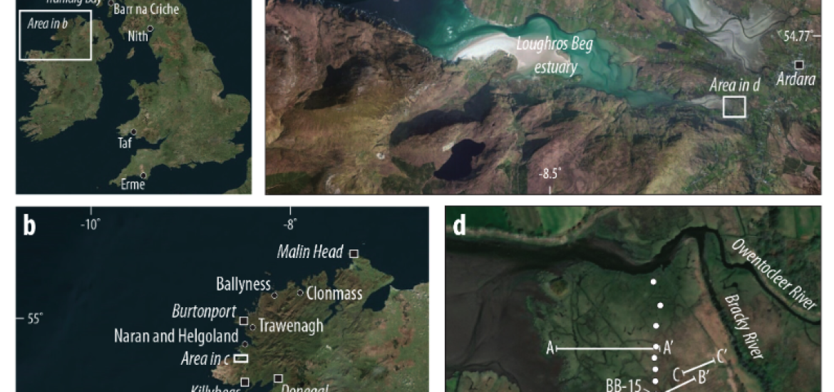
The paper takes a look at the complex history of the late-Quatenary relative sea-level (RSL) of Ireland, with specific focus on the lack of high-quality RSL data in the prediction of mid to Late-Holocene RSL highstand.
The study investigated "model-data discrepancy by reconstructing RSL change from a near continuous salt-marsh sequence at Bracky Bridge, Donegal, spanning the last ca. 2500 years."
The authors' findings are not compatible with previously published sea-level index points from the same region and propose that "These results do not provide any evidence to support a Mid-Holocene RSL highstand above present sea level. Whilst none of the available GIA models replicate the timing and magnitude of the Late-Holocene RSL rise in our reconstruction, those which incorporate a thick and extensive British-Irish Sea Ice Sheet provide the best fit."
> Access the article
> Find out more about the PALSEA working group